
Improved Project Planning

Accurate Cost Estimation

Enhanced Safety

Informed Decision Making

Regulatory Compliance

Environmental Protection

Reduced Construction Delays


+91-9357029010
SCO 43, 2nd Floor, Sector 4,
Panchkula - 134112, Haryana, INDIA
Videos
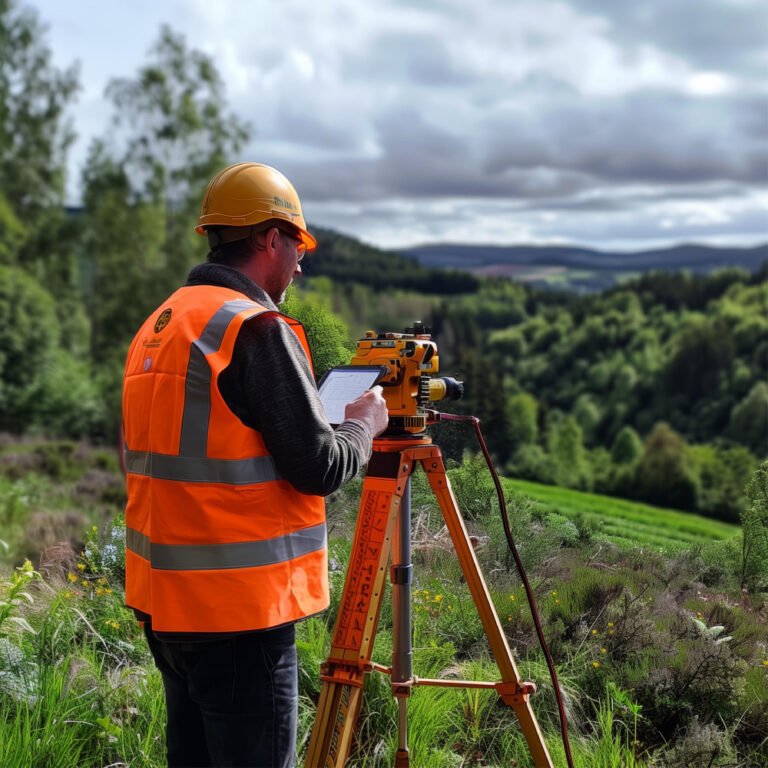
At Design Solutions Inc. provides Topographic Survey Services with detailed mapping of land features, elevations, and contours to support construction, infrastructure, and land development projects.
By capturing precise data on the terrain, these surveys help in planning, designing, and executing projects efficiently, ensuring compliance with regulatory standards and minimizing risks.
Topographic surveys are essential for understanding the physical characteristics of a site, allowing for better decision-making and project optimization.
A topographic survey provides precise mapping of land features, elevations, and contours, offering a detailed view of the terrain.
The survey identifies property lines, boundaries, and potential encroachments, essential for land development and legal purposes.
Elevation measurements are crucial for understanding the slope and grading of the land, which impacts construction, drainage, and design.
The survey locates underground and above-ground utilities, helping prevent interference during construction and ensuring proper planning.
Topographic surveys provide insights into natural land features such as rivers, trees, and wetlands, essential for environmental impact assessments.
Accurate topographic data is critical for the planning and design of infrastructure projects like roads, bridges, and drainage systems.
By analyzing the land’s physical characteristics, a topographic survey helps determine the feasibility of construction, ensuring optimal use of the site.
Surveys generate digital terrain models and contour maps, offering a 3D visualization of the land for better project planning and design.
Elevation and terrain data from the survey help in assessing flood risks and designing proper drainage systems to mitigate water damage.
Topographic surveys are essential for meeting zoning, planning, and building code regulations, ensuring the project complies with all legal requirements.
At Design Solutions Inc. we provide precise elevation and terrain data, it reduces construction risks, minimizes delays, and enables cost-effective resource management. Additionally, it supports environmental protection by identifying sensitive areas, making it an essential tool for successful project execution.